Open GIS Data in Washington Counties
Martijn van Exel’s Missing Roads JOSM plugin uses gps tracks to identify missing roads in OpenStreetMap. Some of the tracks are from trucks working in farm fields. Others are from missing service roads. And some are new construction. If the construction is recent, the TIGER missing roads layer doesn’t help. I’ve found looking at the Counties road centerline data the best way to not only accurately add the new way but also give it the right name.
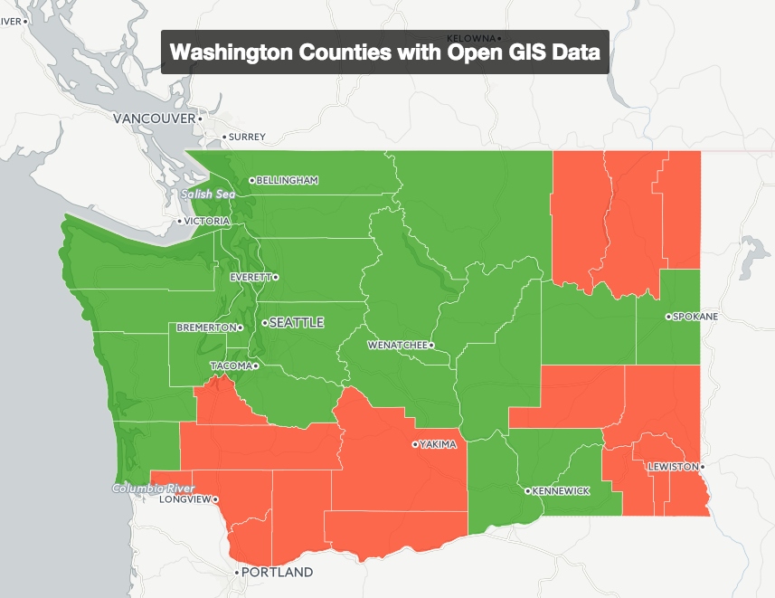
I set about creating a table with all 39 Washington State counties with the counties gis website and if there was gis data available. A typical duckduckgo.com search was skagit county wa gis. I noted if there was any GIS information available. For Whatcom County, I knew that the City of Bellingham had most of the counties data.
I hope to add a link to the licensing page for each county. Stay tuned for future updates.
Graphically this is the results of my inquiry. Click on the image to open to the interactive webmap.